

Visit the EarthView web site to meet the team and learn about the project.
Wednesday, December 30, 2009
Oceania
One of the most important lessons of EarthView is that the earth is mainly covered in water. For decades, Dr. Sylvia Earle has been a leader in helping people to understand and explore oceans. Listen to her conversation with radio host Tom Ashbrook to learn about her work, her leadership as a woman in science, and how she got Google Earth to take oceans seriously! You can even follow the discussion on your own computer, using the new layers in Google Oceans. The Ocean layer includes a lot of links to ocean photos, videos, and more from National Geographic and other partners.

Another surprise for many EarthView visitors is the extent of islands and island chains in the Pacific Ocean. Even for the well-traveled EarthView Team, many of the island nations -- and even the U.S. island territories -- are difficult to place. We are finding the Australia/Oceania quiz from Lizard Point helpful, though we still have a lot to learn about this part of the world.
Tuesday, December 29, 2009
Who gets to say “Happy New Year” first?
This is a very geographic question, posed from the other side of the world by a friend of the EarthView Team! See the blog posting from the Indian Institute of Geographical Studies for a lot of interesting information -- and maps -- about this question. It includes some surprising information about time zones, such as a small island nation that used to have time zones that were 22 hours apart! (Hint: it is near the zipper on EarthView.)
Dr. Chandra Shekhar Balachandran was a professor of geography at Bridgewater State College close to a decade ago, when he worked alongside EarthView Team members Dr. Domingo and Dr. Hayes-Bohanan. Now he pursues geographic education on the other side of the world, where he is a leader of the Indian Institute. Explore the rest of his site for more about what Dr. Balachandran and his colleagues are doing to promote geographic education.
Dr. Chandra Shekhar Balachandran was a professor of geography at Bridgewater State College close to a decade ago, when he worked alongside EarthView Team members Dr. Domingo and Dr. Hayes-Bohanan. Now he pursues geographic education on the other side of the world, where he is a leader of the Indian Institute. Explore the rest of his site for more about what Dr. Balachandran and his colleagues are doing to promote geographic education.
Friday, December 18, 2009
Row for Water
 Katie Spotz is a young Ohioan on a mission that complements one of the major lessons of EarthView. Here she is studying a map of the equatorial portion of the Atlantic as she prepares for a three-month journey rowing from Dakar, Senegal to Cayenne, French Guaina.
 EarthView team member Professor James first learned of Katie's project from her interview on NPR's Talk of the Nation program, on which she discussed the importance of timing and location. Even though her boat and electronic equipment are quite sophisticated, the most important aspect of the journey is that she will be rowing every bit of 2,500 miles. No matter how good the boat is, this feat requires not only extraordinary strength and endurance but also quite careful attention to GEOGRAPHY.
Her route will follow the southern edge of the North Equatorial Current, which itself is the southern portion of the North Atlantic gyre. By leaving Senegal in January, she minimizes the likelihood of major storms (though the boat can handle them) and maximizes the chances that currents will be pushing her in the right direction, toward Cayenne.

Her project is called Row for Water because Katie is traversing salt water as a fund-raiser for a campaign to provide fresh water to 1,000 of the 1,000,000,000 people in the world who do not have a safe and reliable supply. In EarthView, students learn why water can be scarce on a planet that is 70 percent covered by water.
Once Katie departs Dakar, her supporters will be able to track her progress across the Atlantic. Geography students can have classroom contests: How far will she go each day? What will be her fastest day? Her slowest? How close will she get to Cape Verde? When will she arrive in French Guiana? Where will she arrive? What maps can you consult to help you guess some of the answers? What other geographic questions can you think of?
Use the "comment" link below to share the adventure with other EarthView students!
Monday, December 14, 2009
EarthView in a music video
See EarthView in this video about changing the world, from a local New Bedford artist. EarthView makes its appearance at 00:25 seconds.
"Miraculous Apertures" by Tem Blessed from Ben Gilbarg on Vimeo.
"Miraculous Apertures" by Tem Blessed from Ben Gilbarg on Vimeo.
Monday, November 30, 2009
November 30: Pinecroft School at Wheaton College
See the Math!
41° 58' 04" N
71° 10' 44" W
For more coordinates, grab your nearest atlas or check out Stephen Morse. Use this information to figure out how many degrees, minutes, and seconds away the school is from home or from any other place on earth!
Dr. Hayes-Bohanan brought EarthView to the Pinecroft school, which several of his daughter's friends at Northbrook Academy have attended. The visit was actually in the field house of nearby Wheaton College in Norton. This is particularly exciting, because of Wheaton's extensive involvement in international research and learning.

Some geographic events on the date of the visit include:
1988 Soviets stop jamming Radio Liberty; 1st time in 38 yrs
1974 Most complete early human skeleton found (Johanson and Gray in Ethiopia)
1967 Kuria Muria Islands ceded by Britain to Oman
1967 People's Democratic Republic of Yemen declares independence from U.K.
1967 People's Rep of South Yemen (Aden) gains independence from Britain
1966 Barbados gains independence from Britain (National Day)
1962 U Thant of Burma elected 3rd Secretary-General of United Nations unanimously
1961 U.S.S.R. vetoes Kuwaits application for United Nations membership
1954 1st meteorite known to strike a woman (Liz Hodges -- Sylacauga Alabama)
1907 Pike Place Market dedicated in Seattle (eventually became the first Starbucks)
1872 1st International soccer game, Scotland-England 0-0 (Glasgow)
1866 Work begins on 1st U.S. underwater highway tunnel, Chicago
Learn more anniversaries and birthdays at Brainy History.
41° 58' 04" N
71° 10' 44" W
For more coordinates, grab your nearest atlas or check out Stephen Morse. Use this information to figure out how many degrees, minutes, and seconds away the school is from home or from any other place on earth!
Dr. Hayes-Bohanan brought EarthView to the Pinecroft school, which several of his daughter's friends at Northbrook Academy have attended. The visit was actually in the field house of nearby Wheaton College in Norton. This is particularly exciting, because of Wheaton's extensive involvement in international research and learning.

Read about the visit and check out the slideshow on the Pinecroft blog.
Some geographic events on the date of the visit include:
1988 Soviets stop jamming Radio Liberty; 1st time in 38 yrs
1974 Most complete early human skeleton found (Johanson and Gray in Ethiopia)
1967 Kuria Muria Islands ceded by Britain to Oman
1967 People's Democratic Republic of Yemen declares independence from U.K.
1967 People's Rep of South Yemen (Aden) gains independence from Britain
1966 Barbados gains independence from Britain (National Day)
1962 U Thant of Burma elected 3rd Secretary-General of United Nations unanimously
1961 U.S.S.R. vetoes Kuwaits application for United Nations membership
1954 1st meteorite known to strike a woman (Liz Hodges -- Sylacauga Alabama)
1907 Pike Place Market dedicated in Seattle (eventually became the first Starbucks)
1872 1st International soccer game, Scotland-England 0-0 (Glasgow)
1866 Work begins on 1st U.S. underwater highway tunnel, Chicago
Learn more anniversaries and birthdays at Brainy History.
Monday, November 23, 2009
Dec 18: Orleans Elementary
Latitude: 41° 46' 53" N
Longitude: 69° 59' 36" W -- our first program at less than 70 degrees west longitude!
For more coordinates, grab your nearest atlas or check out Stephen Morse
On December 18th, Earthview will be visiting the Orleans Elementary School in Orleans, MA. Our visit happens to fall upon the same date as several historically significant events:
2005 Bolivia elects leftist Evo Morales president
1980 Vietnam adopts constitution
1969 Britain abolishes death penalty
1966 Dr. Seuss' "How the Grinch Stole Christmas" airs for 1st time on CBS
1961 India annexes Portuguese colonies of Goa, Damao and Diu
1958 1st voice from space: recorded Christmas message by Eisenhower
1865 13th Amendment ratified, slavery abolished
1777 1st national Thanksgiving Day, commemorating Burgoyne's surrender
For more events, check out Brainy History
Dec 4th: James M. Quinn School
Latitude: 41° 37' 35" N
Longitude: 70° 57' 48" W
For more coordinates, look at an atlas or use Stephen Morse
We look forward to our visit on December 4th, 2009 to the James M. Quinn School in Dartmouth. Our visit coincides with several important historical and geographical events:
1619 America's 1st Thanksgiving Day (Va)
1945 Senate approves U.S. participation in UN
1963 Aldo Moro forms Italian government
1981 According to South Africa, Ciskei gains independence - Not recognized as an independent country outside South Africa
1982 China adopts its constitution
1908 Birth of: Alfred D. Hershey, U.S. scientist, biologist, worked with bacteriophages, Nobel 1969
1905 Birth of: Emilio Medici, president Brazil, 1969-74
1980 Francisco Sa Carneiro, Prime Minister of Portugal 1980, dies in air crash
For more events, check out Brainy History
Sen. Franken the Geographer
To celebrate Geography Awareness Week in November, National Geographic invited United States Senators to draw maps of their own states. Senator Franken of Minnesota gave his map a lot of thought. Earlier, he drew this map of the United States from memory.
Saturday, November 21, 2009
Small Island Developing States
The first thing most people notice when they enter EarthView is just how much of the earth's surface is covered by water. It is nearly 70 percent, but this is not always obvious from maps.
The second thing is just how many islands are found around the world -- and how little we know about most of them. At the Earth Summit in 1992, small, developing countries on islands were identified as having some common characteristics and concerns. The threat of global climate change makes these concerns even more urgent -- not just because of rising sea levels but also because of the vulnerability of tiny ecosystems to change. On large land masses, we might find that growing areas shift by a couple hundred miles; this is not possible on an island that is ten miles wide!

The Food and Agriculture Organization (FAO) of the United Nations has created the SIDS program as a way to help with food security on small islands around the world. The SIDS web site can also be useful for those who wish to start learning where some of the small island countries are located.
The second thing is just how many islands are found around the world -- and how little we know about most of them. At the Earth Summit in 1992, small, developing countries on islands were identified as having some common characteristics and concerns. The threat of global climate change makes these concerns even more urgent -- not just because of rising sea levels but also because of the vulnerability of tiny ecosystems to change. On large land masses, we might find that growing areas shift by a couple hundred miles; this is not possible on an island that is ten miles wide!
The Food and Agriculture Organization (FAO) of the United Nations has created the SIDS program as a way to help with food security on small islands around the world. The SIDS web site can also be useful for those who wish to start learning where some of the small island countries are located.
Friday, November 20, 2009
MaCIE at BSC
41º 59’17” N
70º 58’21” W
Find the latitude and longitude of your own home or other location in an atlas or at Steve Morse.

To conclude Geography Awareness Week and International Education Week, EarthView is at the annual meeting of the Massachusetts Council for International Education (MaCIE), which is being held Bridgewater State College -- the home of EarthView -- on Friday, November 20, 2009.
70º 58’21” W
Find the latitude and longitude of your own home or other location in an atlas or at Steve Morse.
To conclude Geography Awareness Week and International Education Week, EarthView is at the annual meeting of the Massachusetts Council for International Education (MaCIE), which is being held Bridgewater State College -- the home of EarthView -- on Friday, November 20, 2009.
Monday, November 16, 2009
Endicott College
42° 33' 11" N
70° 50' 50" W
Find the latitude and longitude of your own home or other location in an atlas or at Steve Morse
Dr. Hayes-Bohanan was very pleased to bring EarthView to the beautiful, seaside campus of Endicott College in Beverly. He was there to help the School of International Education kick off its celebration of International Education Week and Geography Awareness Week. EarthView will end the week at home, as Bridgewater State College hosts the annual meeting of MaCIE on Friday.
Members of the Endicott community are invited to post questions, comments, and ideas using the Comments link below.
View Larger Map
Monday, October 26, 2009
Baker School Photo
Students at Baker School in Brockton were thrilled to have EarthView as part of Make-a-Difference Day, and the EarthView Team was thrilled to take part.


Sunday, October 25, 2009
Oct. 30: Berkley Middle School
See the Math?
41° 50' 56" N
71° 05' 03" W
Look up other coordinates in an atlas or at Steve Morse
We look forward to visiting Berkley Middle School on Friday October 30 -- Halloween Eve!
The following is a list of significant geographic and historical events that coincide with the date of our visit:
EVENTS:
1995 Quebec Referendum votes to remain part of Canada
1991 Mid East peace conference begins in Madrid Spain
1982 Portugalrevises constitution
1980 Honduras and El Salvador settle their boundary dispute
1963 Morocco and Algeria signs cease fire
1944 Anne Frank (of Diary fame) is deported from Auschwitz to Belsen
1918 Slovakia asks for creation of Czechoslovakian state
1493 Christopher Columbus discovers island of Dominica
BIRTHDATES:
1735 John Adams in Braintree, Massachusetts; 2nd president of the United States from 1797 - 1801
Source: Brainy History - October 30th
41° 50' 56" N
71° 05' 03" W
Look up other coordinates in an atlas or at Steve Morse
We look forward to visiting Berkley Middle School on Friday October 30 -- Halloween Eve!
The following is a list of significant geographic and historical events that coincide with the date of our visit:
EVENTS:
1995 Quebec Referendum votes to remain part of Canada
1991 Mid East peace conference begins in Madrid Spain
1982 Portugalrevises constitution

1980 Honduras and El Salvador settle their boundary dispute
1963 Morocco and Algeria signs cease fire
1944 Anne Frank (of Diary fame) is deported from Auschwitz to Belsen
1918 Slovakia asks for creation of Czechoslovakian state
1493 Christopher Columbus discovers island of Dominica
BIRTHDATES:
1735 John Adams in Braintree, Massachusetts; 2nd president of the United States from 1797 - 1801
Source: Brainy History - October 30th
Monday, October 19, 2009
Oct. 23: Baker School, Brockton
See the Math? Baker School is at
42° 5' 49 N
70° 59' 24 W
Find the latitude and longitude of other places on your globe, in your atlas, or at Steve Morse. Then do some math!
On October 23, we visited the Baker School Elementary in Brockton, Massachusetts. Teachers and students are invited to use the "comment" link below to post questions for the EarthView Team. We are especially glad to be visiting this GREEN building, which is similar to the new GREEN science building where EarthView will be kept at Bridgewater State College.
We are also delighted that geography professors from Brazil joined us for part of our visit at Baker School.
Dr. Hayes-Bohanan told some classes about the "wedding of the waters" in Manaus, Brazil. Explore the area on Google Maps to see where Manaus is, relative to the rest of the continent. This is a false-color image, typical of many satellite images. Tan is shown as blue and urban areas as pink. Geographers learn how to use satellite data to get information about places that is more detailed than what we see in photographs; false-color images are one example.
See the Rio Negro entering from the WNW and the Rio Solimões entering from the West and WSW. As they continue past Manaus, the tea-like water of the Rio Negro remains along the left bank (north side) of the Amazon -- which is officially formed at this confluence -- for many miles. Use the scale on Google Maps to figure out how far. Visit Dr. Hayes-boh's Rondonia Web for stories about his time in the Amazon.
View Larger Map
Our visit on this day also coincides with a great number of geographically significant anniversaries and birthdays, including:
1989 Hungary proclaims itself a republic and declares communist rule ended
1978 China and Japan formally end 4 decades of dissension
1977 Panamanians vote 2:1 to approve new Canal treaties
1975 Battle between Cuba and South Africa troops in Angol
1954 Britain, England, France and U.S.S.R. agree to end occupation of Germany
1954 West Germany joins NATO
1953 France grants sovereignty to Laos
1956 Revolt against Stalinist policies begins in Hungary
787 Byzantine empress Irene recovers Iconclastic cult at Nicaea
BIRTHDATES:
1922 Stuart Sloan, war hero/test pilot
1905 Felix Bloch, Swiss/U.S. nuclear physicist, Nobel 1952
1868 Rama V, [Chulalongkorn], leader of Thailand, -1910
Friday, October 16, 2009
GEOGRAPHIC BEE
The final deadline for registration has been extended to December 11, 2009. After October 15, the registration fee increases to $90. School level Bees can be held up to January 15, 2010. Go to www.nationalgeographic.com/geographicbee to get complete information and other dates and deadlines.
Thursday, October 8, 2009
First Aerial Photo -- 1860

Aerial photographs are an important tool for cartographers and other geographers. In fact, most geography departments offer entire courses in the interpretation of photographs taken from above. Most of these are taken from specially-equipped airplanes with cameras mounted on the bottom, but early aerial photography relied on hot-air balloons. The very first was taken in Boston on this date in 1860!
Read the Mass Moments article for details.
Saturday, September 26, 2009
October 2: Plouffe Academy, Brockton
42° 04' 48" N
71° 00' 40" W
Source: Steve Morse
We look forward to visiting Plouffe Academy in Brockton on October 2. EarthView Team member Dr. Hayes-Bohanan fondly remembers meeting Plouffe students (who are now adults) the first time he participated in BSC's Turning Leaves program.
Plouffe teachers and students are invited to use the "comment" link below to post questions for the EarthView Team.
Our October 2 visit is on the anniversary of several historic events and birthdays with geography connections.
EVENTS
1608 Prototype of modern reflecting telescope completed by Jan Lippershey
1836 Darwin returns to England aboard HMS Beagle (after 5 years)
1870 Italy annexes Rome and Papal States; Rome made Italian capital
1889 1st Pan American conference (Washington D.C.)
1895 1st cartoon comic strip is printed in a newspaper
1932 Washington Redskins (as Boston Braves) play 1st NFL game, lose 14-0
1949 U.S.S.R. recognizes People's Republic of China
1950 1st strip of Charlie Brown, "Li'l Folks," later "Peanuts" in 9 papers
1956 1st atomic power clock exhibited-NYC
1957 New volcano appears at western end of Faial Island, Azores
(See photo & story or find the volcano on this satellite image.)
1958 Guinea (French Guinea) gains independence from France
1967 Thurgood Marshall sworn in as 1st black Supreme Court Justice
1968 Republic Guinea forms
1971 Homing pigeon averages 133 KPH (record) in 1100-km Australian race
BIRTHDATES:
1869 Mahatma Karamchand Ghandi, Porbandar Kathiawad India, pacifist
1800 Nat Turner, Virginia, leader of major slave rebellion, 1831
Tuesday, September 22, 2009
Citizens for Citizens Follow-up
As mentioned in the July blog entries, Dr. Hayes-Bohanan co-led an EarthView program with his student Nathan Couto at Citizens for Citizens in Fall River, where Mr. Couto works throughout the year. The organization's blog entry includes photographs of the two geographers and the children who participated, along with a good description of an EarthView program and the program's long-term learning goals.
Driscoll School - September 25

42° 20' 29" N
71° 08' 12" W
Source: Steve Morse
The EarthView team will be traveling to Brookline, where team member Dr. Domingo led a Geography Summer Institute earlier in 2009. Dr. Hayes-Bohanan enjoyed leading one small part of that institute, as he described the geography of Latin America. They both thoroughly enjoyed working with Brookline teachers in the beautiful building that houses the Driscoll School. Dr. Domingo will be at a geography conference during this visit, but Dr. Hayes-Bohanan and the rest of the team are looking forward to the visit.
Our September 25 visit coincides with a great number of geographically signficant anniversaries, including:
1992 Opening Main-Donau canal (North Sea-Black Sea)
1992 U.S. Mars Observer launched from Space shuttle
1987 2nd coup on Fiji led by Major General Sitiveni Rabuka
1984 Egypt and Jordan regain diplomatic relations
1973 Three-man crew of Skylab 3 make safe splashdown in Pacific after 59 days
1965 Beatle cartoon show begins in U.S.
1957 Three hundred US Army troops escort nine African-American children to Central School in Little Rock, Arkansas
1957, 1974, 1980, 1982, and 1983: UK, US and/or USSR nuclear tests, sometimes on the same day
1956 First transatlantic telephone cable goes into operation (Scot-Canada)
1939 Versailles Peace Treaty forgot to include Andorra, so Andorra and Germany finally sign an official treaty ending WW I
1926 Henry Ford announces 8 hour, 5-day work week
1867 Congress creates 1st all-African American university, Howard University in Washington D.C.
1639 First printing press in America
Source: http://www.brainyhistory.com/
Southbrook Academy
41° 59' 25" N
70° 56' 48" W
Source: Steve Morse
Southbrook Academy is a small school with a special significance for EarthView team member Dr. Hayes-Bohanan: his daughter enjoyed six years of nurturing and challenge there, until just over a year ago. So he is delighted to be hosting Southbrook students when they come to an EarthView program at the college. It is a chance to give back a little to a school that has given much to his family!
Whittemore Elementary in the Daily News Tribune

The report also captures both the richness and the excitement of the experience for the EarthView team, local educators, and students.
Saturday, September 19, 2009
Peace Vigil
41° 59' 18" N
70° 58' 26" W
Source: Steve Morse
On Saturday, September 19, EarthView is part of the 24-hour community peace vigil that takes place every year in Bridgewater as part of World Peace Day. EarthView will be set up in the sanctuary at First Parish Church at 50 School Street through much of Saturday afternoon and evenings. Because it is on a platform above the views, it will be seen only from the outside.
Look for photographs after the event!
Friday, September 18, 2009
Henry Whittemore School - Waltham
42° 21' 58" N
71° 13' 48" W
Source: Steve Morse
The EarthView team visited the Whittemore School in Waltham on September 18, 2009. It is the birthday of Lance Armstrong, who was born in 1971.
Some geographically significant anniversaries today are:
1997 Ted Turner gave $1 billion to the United Nations
1990 500-pound Hershey Kiss was displayed in Times Square
1987 U.S. and Russia signed an agreement to remove mid-range missiles
1962 Rwanda, Burundi, Jamaica and Trinidad were admitted (105th-108th) to United Nations
1851 New York Times started publishing at 2 cents a copy
1793 President Washington laid the cornerstone of Capitol building
Saturday, September 12, 2009
Upcoming EarthView visits
The EarthView team looks forward to visiting the schools listed below over the coming weeks. Details -- such as the latitude and longitude of each school -- will be included in blog postings to come.
September 18: Henry Whittemore Elementary, Waltham
September 25: Driscoll School, Brookline
October 2: Plouffe Academy, Brockton
October 23: Baker School, Brockton
December 4: James M. Quinn School, Dartmouth
Some dates are likely to be added as we continue to work out schedules with schools that have expressed interest. To bring EarthView to your school, please look at the program requirements on the EarthView web site and use the contact information provided there.
Wednesday, September 9, 2009
Globe Art

The EarthView team is interested in maps and globes of all kinds, and even during the summer, globes are a big part of what we do ... or a little part, in this case.
A friend of Dr. Hayes-Bohanan noticed the globe painted on the newel post inside his home in Bridgewater, and asked him to do the same at her house.
After months of planning, the project was completed this August. First, the homeowner painted the sphere at the top of the post entirely blue, and then it was allowed to dry thoroughly. Then Dr. Hayes-Bohanan drew the graticule on the sphere in 30-degree increments with a pencil (the high latitudes of the Southern Hemisphere were excluded). The twin grooves at the center were taken to represent 5 degrees north and south latitude. Drawing the entire globe freehand would have been impossible, but within each 30x30-degree quadrangle (triangles at the top), it was feasible to draw the continents and major islands with reasonable accuracy. After the painstaking pencil work, painting with exterior house paint required only a few more hours. Both the artist and the homeowners were pleased, and a little geographic education will take place every time a new person visits this house!
 The scale of the final result is quite small, roughly 1:100,000,000, about 100 times smaller than EarthView. This means, by the way, that a million of these globes would fit inside EarthView!
See more photos on Flickr.
John J. Ahern School -- Foxborough
42° 4' 27" N
71° 14' 18" W
Source: Steve Morse
... or is it Foxboro? The "boro" towns in Massachusetts often come with two spellings, much like the "ham" towns come with two or three pronunciations.
The EarthView team is looking forward to its first engagement of the new school year, returning to the Ahern School in Foxborough on Friday, September 11. We are looking forward to our visit, and we invite Ahern students and teachers to post their geography questions here, and to explore the rest of the EarthView blog.
Friday, September 4, 2009
Puzzle and Game Maps
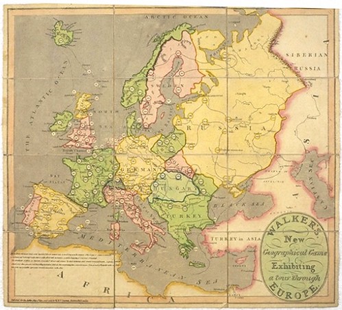
Games have been a popular way to learn geography for centuries -- even before the Internet! In fact, this article at BibliOdyssey mentions that jig-saw puzzles were invented just prior to the American Revolution, and for 20 years, the only depicted maps!
Read the article to learn about pre-1900 geography games, so you know what to look for the next time you are in an antique shop. And keep this tradition in mind the next time you play geography games online!
Tuesday, July 14, 2009
Citizens for Citizens, Inc.
at the William S. Green School
N 41° 41' 11.0"
W 71° 9' 7.8"
Source: Steve Morse
EarthView is pleased to be visiting the Citizens for Citizens program at the Greene School in Fall River. Thanks to CFC employee and BSC geography student Nathan Couto for making the connection!
Students, staff, and parents are encouraged to post geography questions here!
Monday, June 29, 2009
The Presidential Map

Here is an important message for fans of EarthView: President Obama likes maps, too!
On June 10, the president received a map from the National Geographic Society (which also sponsor's our Globe Lady's program, MyWonderfulWorld.org). President Obama started studying the map right away! It is amazing what you can learn, just by looking at a map.
Wednesday, June 17, 2009
What is your state crustacean?
Geographers have noticed that people identify characteristics of their home regions that are distinctive. Together these characteristics define what geographers call a sense of place. In Maryland, the blue crab is just one of several symbols of which Marylanders are rightly proud.
Read about these symbols and then do some research on the symbols -- official or informal -- of your own state. Be sure to explore the rest of the Maryland Kids Page -- it teaches a lot of geography!
Read about these symbols and then do some research on the symbols -- official or informal -- of your own state. Be sure to explore the rest of the Maryland Kids Page -- it teaches a lot of geography!
Tuesday, June 16, 2009
Sporcle
Read about Sporcle in the Boston Globe! The article is about geography games online, and features BSC geography enthusiast Megan Goodrich. Learn about more geography games from EarthView member Dr. Hayes-Bohanan at http://webhost.bridgew.edu/jhayesboh/geogames/.
Thursday, June 11, 2009
Wrapping up the year

EarthView reached 10,000 students at several dozen schools during its debut year. The EarthView team was very pleased to end this very exciting year in our own back yard -- at the Mitchell School in Bridgewater.
Read the Bridgewater Independent article and see a video that really captures the spirit of EarthView!
Tuesday, June 9, 2009
Global Message
Read this great message from buildings throughout the world!
The EarthView team learned about GeoGreeting from one of our BSC geography alumni, Kristan. She is a planner in the town of Danvers -- one of the many BSC graduates putting her geographic education to work in our region.
The EarthView team learned about GeoGreeting from one of our BSC geography alumni, Kristan. She is a planner in the town of Danvers -- one of the many BSC graduates putting her geographic education to work in our region.
Coverage of EarthView visit to Davis
The May 8 & 15 visit to Davis School has led to this very nice article on the Brockton Public Schools web site. The superintendent of schools and the president of the college were both able to join students that day, and made some interesting comments about geography education.
Saturday, May 30, 2009
Mitchell Elementary School - Bridgewater
N 41° 58' 36.3504"
W 70° 58' 52.5"
Source: Steve Morse
Our last visit of the school year will be to one of our closest neighbors. We are looking forward to bringing EarthView to the George Mitchell Elementary School.
Some geographically interesting events on this day in history include:
1661 Isaac Newton began studying Trinity College, Cambridge; he later described the law of gravity
1846 Telegraph line opened between Philadelphia and Baltimore
1907 Automatic washer and dryer were introduced
1945 U.S., U.K., U.S.S.R., France declared authority over Germany
1947 Secretary of State George C. Marshall outlined Marshall Plan for rebuilding Europe after World War II
1972 U.N. Conference on Human Environment opened in Stockholm, Sweden
1979 Seychelles adopted its constitution -- Seychelles National Day
1991 Space Shuttle Columbia 12 launched
also in 1991 Mikhail Gorbachev received the Nobel Peace Prize
Learn more events and birthdays at Brainy History.
Friday, May 29, 2009
Dennett Elementary, Plympton
N 41° 58' 22.269"
W 70° 48' 4.8485"
Source: Steve Morse
On May 29, we are pleased to be making our first visit to Plympton with EarthView (though team member Dr. James goes to Plympton often to visit his favorite farm. A number of geographically interesting events took place on this day in history:
1990 Boris Yeltsin is elected president of the Russian republic
1989 Student protesters in China construct a replica of Statue of Liberty
1953 Edmund Hillary and Tensing Norkay are 1st to reach summit of Everest
(Thanks to http://www.brainyhistory.com/!)
During most of our EarthView visits, we describe how Mount Everest was formed. We'll make a special point of it in this visit.
As always, we invite Dennett students and teachers to post questions and comments following our visit!
Thursday, May 28, 2009
EarthView in the Tantasqua Town Common
During the first year of the EarthView program, the EarthView team has been pleasantly surprised to find how many small, independent newspapers are operating in our region. We have been very impressed with the commitment many of these papers have to their local schools. This article about EarthView by Town Common reporter Jennifer Grybowski is a shining example.
Thursday, May 21, 2009
Quabbin Regional Middle School
N 42° 23' 59.7646"
W 72° 6' 45.5674"
Source: Steven Morse
At the invitation of our colleague Erin Stevens, the EarthView Team is doing a special evening presentation. This will be the first time that we have taken EarthView to two schools in a single day. The evening program at Quabbin will also be the first time that students using EarthView in one room will be using our large-scale flat map (a giant jigsaw puzzle, really) of the United States in another.
Students can post follow-up questions on the blog or take our lat-long challenge. Using latitude and longitude, find the shortest distance between the two schools EarthView is visiting on May 21.
Tantasqua Regional Junior High School
N 42° 9' 8.9575"
W 72° 7' 46.4977"
Source: Steven Morse
We are delighted to be taking EarthView to the school where one of our team members spent most of her teaching career. Tantasqua is where Ms. Rosalie Sokol became a geography teacher, so it is a very exciting place to visit as the first year of the EarthView program nears its conclusion. About 250 Tantasqua students will have been added to the more than 8,000 students reached by Project EarthView in its inaugural year.
GEO Quiz -- from Public Radio International

The GEO Quiz from PRI's The World is not like most geography quizzes. Each question is a geography lesson unto itself, with follow-up information from the radio program.
Play GEO quiz online or on the radio (WGBH-Boston and many other stations) to test your geographic knowledge and build new knowledge at the same time.
Thursday, May 7, 2009
Creating Global Schools
N 42 ° 21' 11.5"
W 71 ° 3' 17.3"
(Source: geocoder.us)
On May 12, EarthView coordinators and Professors of Geography, Dr. Domingo and Dr. Hayes-Bohanan will be participating in an exciting program about international education. Over 130 leaders from the education, business, policy, and international communities of Boston will come together for an important conversation about globalizing education. The featured panelists will be the Consuls General for Boston of Cape Verde, Spain and Japan.
Bridgewater State College has a strong tradition of involvement in Cape Verde, where we work closely with the Ministry of Education on various initiatives and in Japan, where the very first teacher's college was established by a Bridgewater Normal School graduate over a century ago.
Sunday, May 3, 2009
Edgar B. Davis School, Brockton (May 8 & 15)
N 42 ° 3' 14.5"
W 70 ° 59' 58.4"
(Source: geocoder.us)
The EarthView team will be visiting the Davis School in Brockton on both May 8 and May 15. We are making two visits because this is a combined elementary and middle school that hosts many of our education students, particularly our international students pursuing education careers.
The team is especially looking forward to this visit to a school with which Bridgewater State College has many strong connections.
We anticipate a lot of good questions during our visit. Davis students can use the "comments" link below to send us questions about geography before or after our visits!
Friday, May 1, 2009
Trinity Catholic Academy, Brockton
N 42 ° 4' 51.2" W 71 ° 0' 23.0"
(Source: geocoder.us)
The EarthView team enjoyed the welcoming atmosphere of Trinity Academy on May 1. Students were curious and appreciative, and the attentive teachers and staff ensured a very pleasant experience.

(Source: geocoder.us)
The EarthView team enjoyed the welcoming atmosphere of Trinity Academy on May 1. Students were curious and appreciative, and the attentive teachers and staff ensured a very pleasant experience.

It was great to meet yet another BSC Geography alumna. Ms. Yvette Joyce's class had a lot of great geography questions to ask!
Team member Dr. James promised the fifth graders a link to his web pages about his 2003 study tour in Cuba. It will be interesting to see what happens now that the U.S. government is starting -- in very small ways -- to change its approach to this very interesting country.
Thanks, Trinity students for your attention and your great questions during the EarthView visit. Post more questions here, and we will try to find some answers!
Thanks, Trinity students for your attention and your great questions during the EarthView visit. Post more questions here, and we will try to find some answers!
Friday, April 10, 2009
Saint Anna School
On Friday, April 17, EarthView will be visiting Saint Anna School in Leominster -- the first of several forays we will be taking into north-central Massachusetts this spring.
Saint Anna students are invited to post questions about EarthView as comments on this blog posting before or after the visit.
Saint Anna students are invited to post questions about EarthView as comments on this blog posting before or after the visit.
Saturday, April 4, 2009
Geography overview
As the geography editor for About.com, Matt Rosenberg reviews a lot of geography items online, so he knows what an exciting and varied discipline it is. In his Geography 101 article, he provides a good introduction to what he calls the "mother of all sciences."
Tuesday, March 31, 2009
Middleboro High School
On April 1, we are taking EarthView to Middleboro High School for our presentation at the high school level. In Massachusetts, geography is almost exclusively a middle-school subject. Teachers and administrators at MHS invited us to their school because they recognize the importance of geography as part of global education.
In conjunction with the EarthView visit, graduate students in BSC's Jordan program will discuss their home country and the BSC-Jordan exchanges, and Dr. Hayes-Bohanan will give a talk on the cultural geography of Latin American music.
Middleboro HS students who participate in this program are invited to use the "Comments" link below to ask follow-up questions related to any of these presentations.
Monday, March 30, 2009
Geographic Literacy by 2025
"Most Americans don't have any idea how much better their lives and our world could be if they could all do geography."
~~ Daniel C. Edelson, VP for Education, National Geographic Society
Read why better geographic education matters to everyone, in Geo Learning, a new feature of ArcNews magazine.
~~ Daniel C. Edelson, VP for Education, National Geographic Society
Read why better geographic education matters to everyone, in Geo Learning, a new feature of ArcNews magazine.
Deepest mines
EarthView helps us to understand that humans rely on a very thin layer of resources very close to the Earth's surface. For example, the deepest mines in the world would be only about 2 mm deep at EarthView scale. The Physics Factbook offers a good explanation of how heat and pressure combine to limit the depth of mining.
Even at its very thickest, by the way, the Earth's crust would only be about 17 mm thick at EarthView scale.
Even at its very thickest, by the way, the Earth's crust would only be about 17 mm thick at EarthView scale.
Sunday, March 29, 2009
Visit to Carver
Many thanks to Mr. Wechter and the other teachers and staff at Carver Middle School for a very rewarding visit there on March 13. Bobbi Sistrunk published a well-written article about the program for the Carver Reporter. The online version includes a nice video she prepared.
Martin Middle School Visit!
Ashley Lopes wrote a nice article about our visit to Martin Middle School in the March 28 issue of the Taunton Daily Gazette.
Students from Martin asked more questions than the EarthView team had time to answer. Any Martin students who want to follow up can use the "comments" button on this post to ask your questions about the Earth or EarthView!
Students from Martin asked more questions than the EarthView team had time to answer. Any Martin students who want to follow up can use the "comments" button on this post to ask your questions about the Earth or EarthView!
Friday, March 27, 2009
Welcome to BSC EarthView
EarthView is an outreach project of the Department of Geography at Bridgewater State College in Bridgewater, Massachusetts. The EarthView team travels to schools in Southeastern Massachusetts with a 22-foot, inflatable classroom in the form of a globe. The beauty of EarthView is that students can explore the earth from the inside!
Complete information about EarthView and the EarthView team is available at the main web site: www.bridgew.edu/EarthView.
The purpose of this blog is to record visits of EarthView to area schools, youth clubs, and other organizations, and to give participants an opportunity to follow up with their questions. Thanks to the students at Martin Middle School in Taunton, Massachusetts for asking so many good questions that we decided to start this blog!
Subscribe to:
Posts (Atom)