Visit the EarthView web site to meet the team and learn about the project.

Thursday, November 11, 2010

Trinity Catholic Academy, Brockton -- Nov 12

N 42 ° 04' 51.2" 
W 71 ° 00' 23.0"
Learn more about Lat/Long (including how to look them up by address)
Here is a challenge: This school is close to the only land-based degree confluence in Massachusetts. How far is it from that point in degrees, minutes and seconds? How far is it in miles or kilometers?


The EarthView team is looking forward to its return to Trinity Catholic Academy, which we last visited in May, 2009. We have literally seen thousands of students since then, but we look forward to returning to Trinity, where our own Ms. Joyce is one of the teachers. We know her students will be ready with great geography questions for the team.

Saturday, November 6, 2010

Largest Countries

Although the EarthView globe does not show political boundaries, we often discuss the locations of countries, especially those with the largest populations. As of 2010, the ten most populous countries are those listed above. The U.S. Census Bureau's country rankings page allows users to find the rank of any country in any year from 1950 to 2050 (future rankings are estimates, of course).

To make direct comparisons possible, the database shows the ranking of Russia for all years, even though prior to 1991 it was not listed separately and was part of the Soviet Union's number-three ranking. Its first post-Soviet ranking was number six, but it has now fallen to number nine. Use the database to estimate when Russia will drop from the top-ten ranking in population.

Its position as the largest country by land area will not change, of course, as 11.5 percent of the earth's land is in Russia, no matter how many people live there.


COUNTRY OR AREA
POPULATION
2010
China
1,330,141,295
India
1,173,108,018
United States
310,232,863
Indonesia
242,968,342
Brazil
201,103,330
Pakistan
184,404,791
Bangladesh
156,118,464
Nigeria
152,217,341
Russia
139,390,205
Japan
126,804,433

This map was created by the US CIA but is
hosted on the web site of the Embassy of Russia to the UK

Armenian Sisters' Academy, Lexington -- November 15

42° 26' 16" N
71° 13' 06" W

Learn more about Lat/Long

Members of the EarthView team and other Bridgewater State University Geographers are looking forward to a visit to the Armenian Sisters' Academy in Lexington on November 15. Our visit is on the anniversary of several interesting geographic events, which are listed at the end of this post.

The school was founded by Sister Alphonsa Bedrosian, beginning as a much smaller institution in Watertown and expanded on its current campus in 1982. The school serves both Armenian and non-Armenian children through middle school, with an emphasis on Armenian history and culture. The Armenian Sisters of the Immaculate Conception operate the academy in Lexington as well as two others in the United States -- in Philadelphia and Los Angeles -- as well as others throughout the world.


View Larger Map


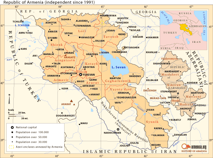
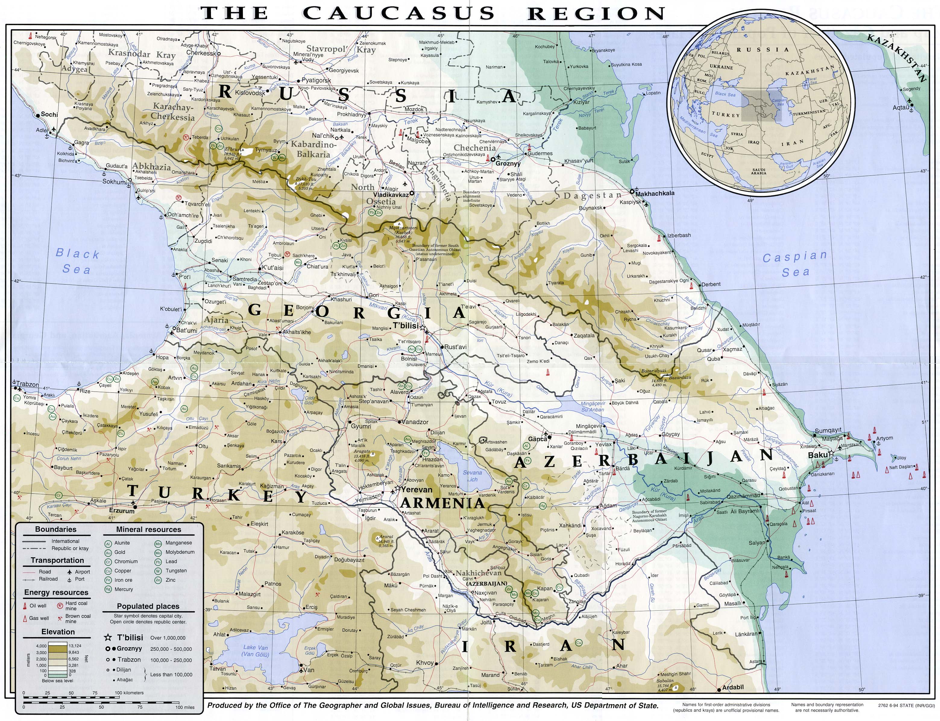
Armenia is a small country located in the center of the Caucasus region of southeastern Europe. Many Armenian Americans live in the greater Boston area. See the Armenia maps at the Perry-CastaƱeda Library Map Collection for more maps Armenia and the surrounding region, reflecting boundaries recognized by the United States. Also see the fascinating and complete collection of maps at Armenica.org. We are using maps from both collections in a special slide show for students at the Academy.

The EarthView visit takes place on the anniversary of several significant geographic milestones.


November 15, 1990
President Bush signed the Clean Air Act Amendments of 1990, making the 1970 law stronger
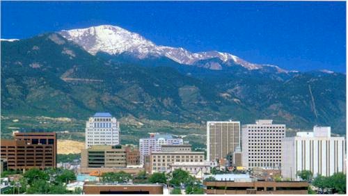


November 15, 1806
Explorer Zebulon Pike sighted Pikes Peak, in Colorado, which was later named in his honor.
Image: Pikes Peak Radio & Electronics Museum

November 15, 1763
Almost a century before the U.S. Civil War, Charles Mason and Jeremiah Dixon began surveying Mason-Dixon Line between Pennsylvania and Maryland.


Monday, November 1, 2010

North Reading Middle School

42° 34' 36" N
71° 05' 17" W

Learn more about Lat/Long

North Reading is the home of Jon Favreau, who graduated from North Reading High School less than a decade ago and is already the chief speech-writer for President Barack Obama.

The EarthView team is visiting North Reading Middle School on November 5, on the 75th anniversary of the board game Monopoly. What is geographic about this game? (Hint: In 1972, fans of the game actually prevented a U.S. city from changing the names of two of its streets!)

November 5 is also the date on which -- in 1492 -- Christopher Columbus first learned about corn, the cultivation of which had by then already spread from central Mexico to the island of Cuba. What is the importance of corn today?